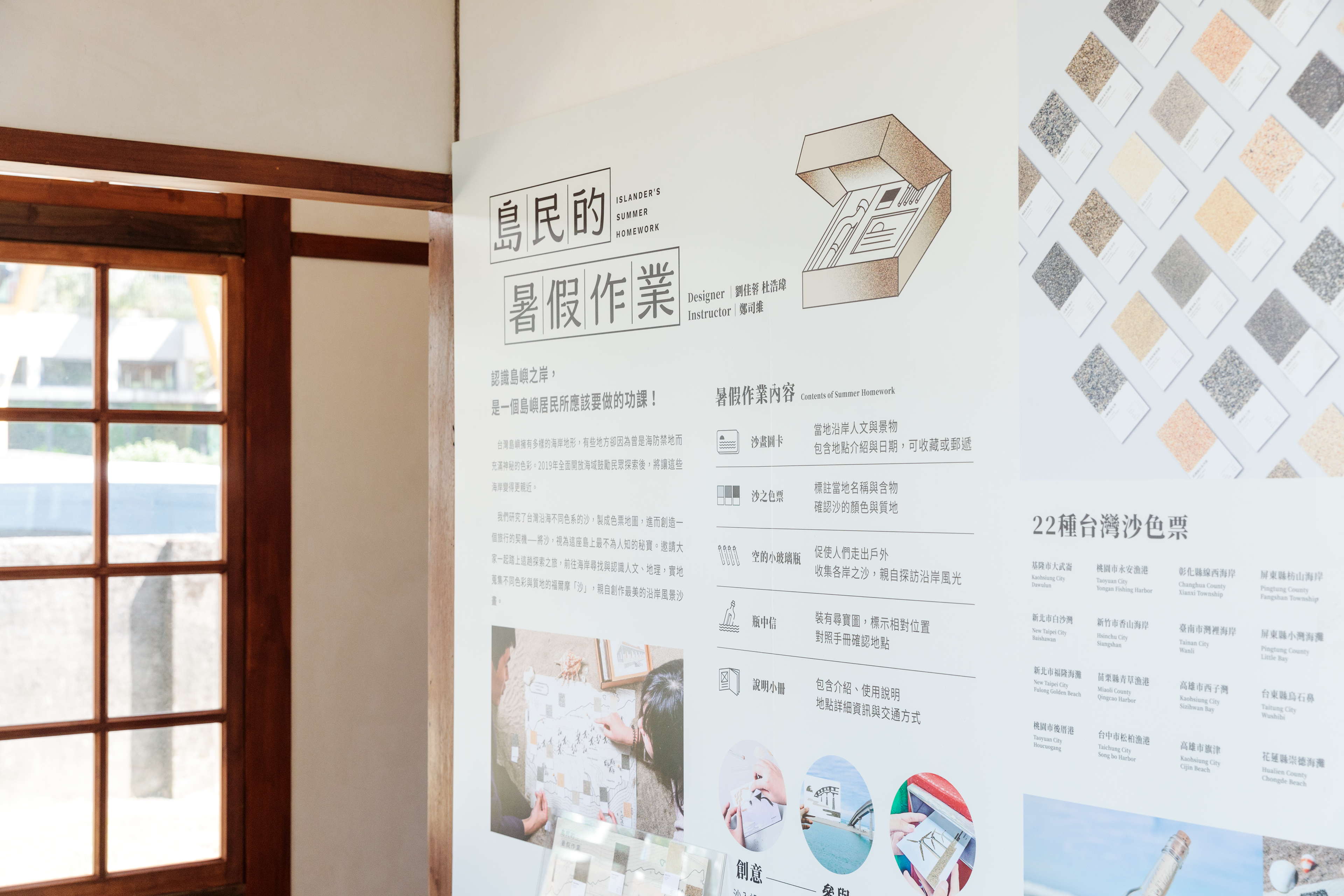
Islander's summer homework
Background:
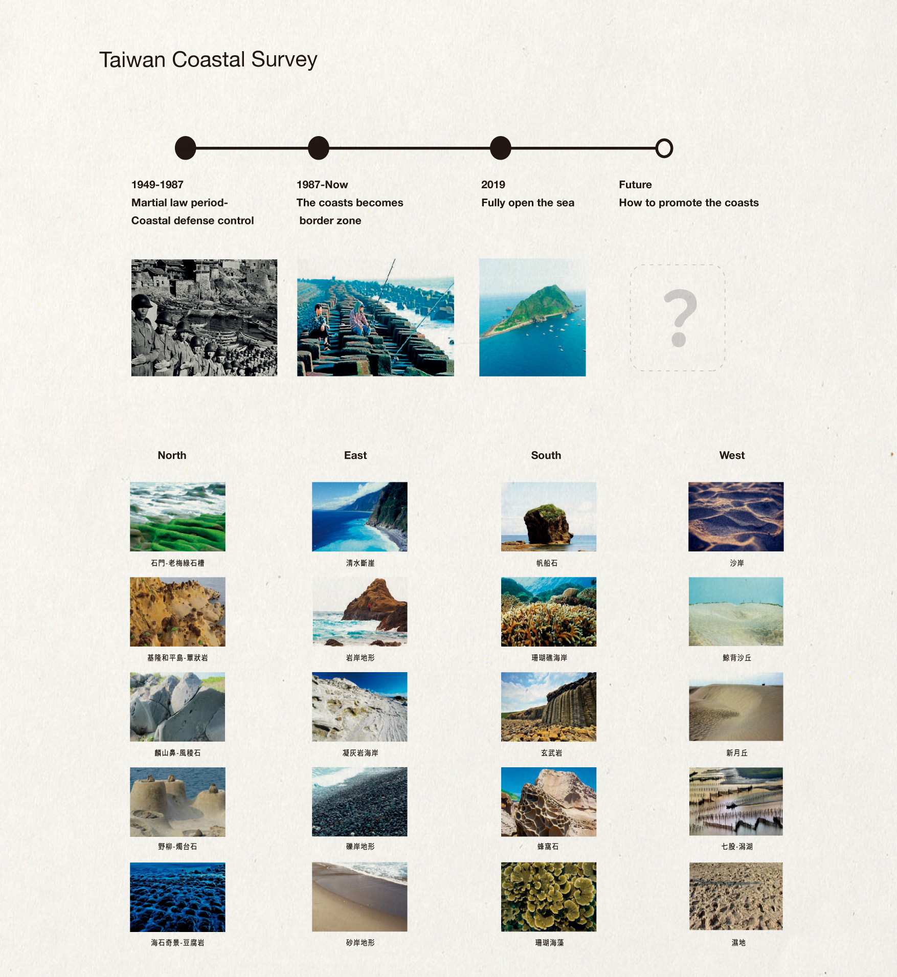
From 1949 to 1986, Taiwan imposed martial law, the second-longest in the world, for 38 years. Martial law has a pervasive impact on life. Especially on the island of Taiwan, which is surrounded by sea on all sides, for the government, the sea does not symbolize freedom, opportunity, and adventure; on the contrary, the sea is synonymous with danger, infiltration, and defection. Therefore, in the eyes of people who have experienced the martial law era, the coastline is like a curse, and the sea is a restricted area where trespassing is strictly prohibited.
From 1949 to 1986, Taiwan imposed martial law, the second-longest in the world, for 38 years. Martial law has a pervasive impact on life. Especially on the island of Taiwan, which is surrounded by sea on all sides, for the government, the sea does not symbolize freedom, opportunity, and adventure; on the contrary, the sea is synonymous with danger, infiltration, and defection. Therefore, in the eyes of people who have experienced the martial law era, the coastline is like a curse, and the sea is a restricted area where trespassing is strictly prohibited.
Task:
Now the government has launched laws and policies to encourage Taiwanese to get close to the coastal areas, but they are barely successful.
Now the government has launched laws and policies to encourage Taiwanese to get close to the coastal areas, but they are barely successful.
Strategy:
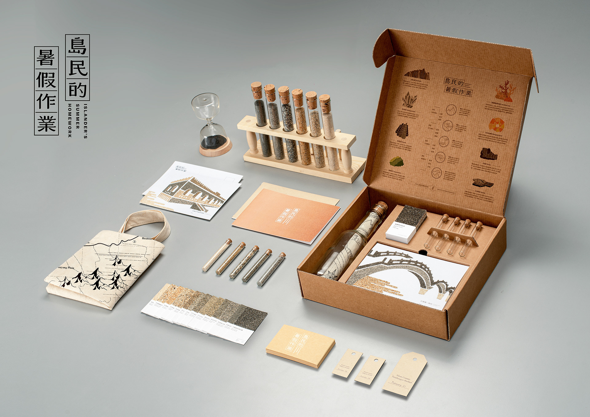
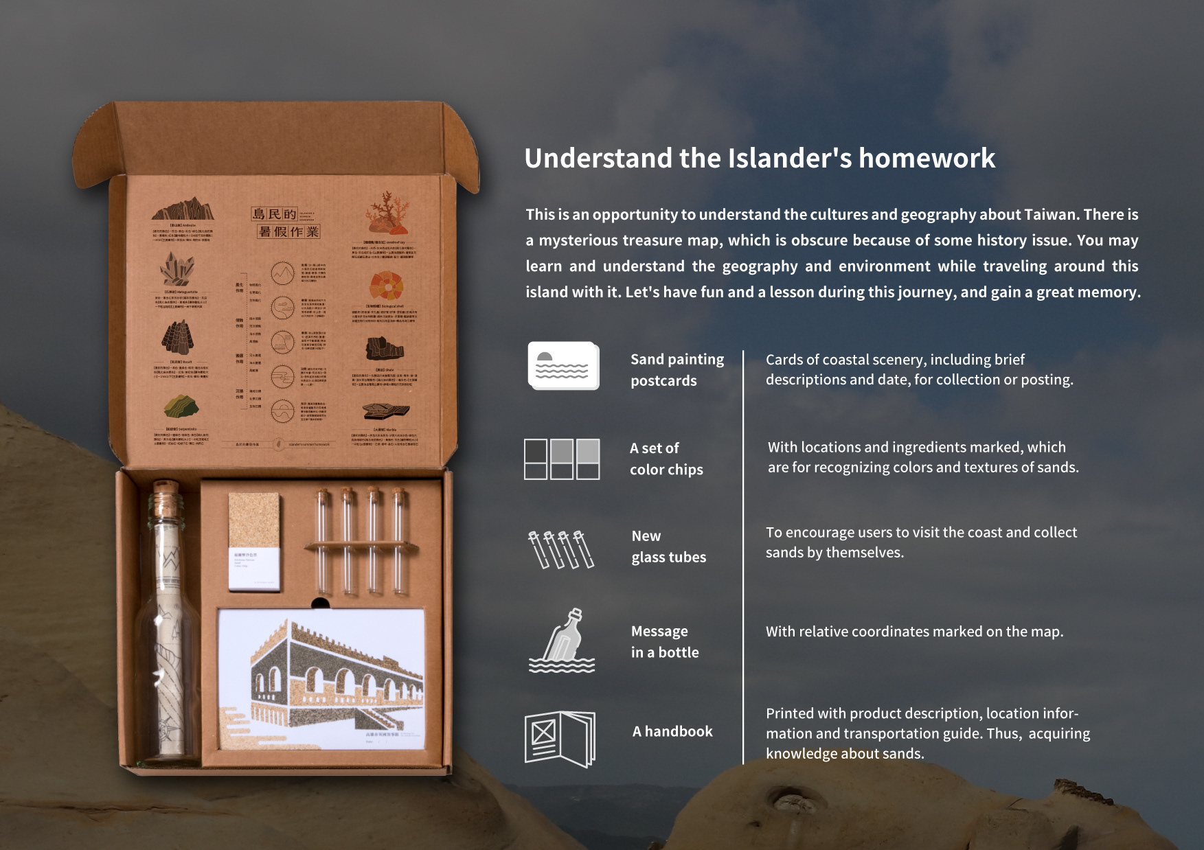
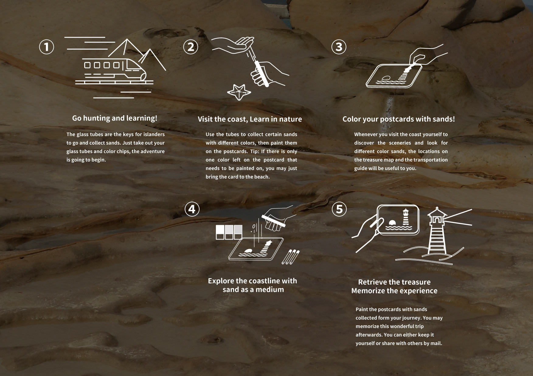
To help the government promote their policies and geography education, we walked to the coast ourselves, explored the coast instead of making designs in a room. After it, We found the amazing colors of sands in Taiwan. At the same time, we decided to create a mission, a package, to encourage people to go to shore in person and break through the pain of history.
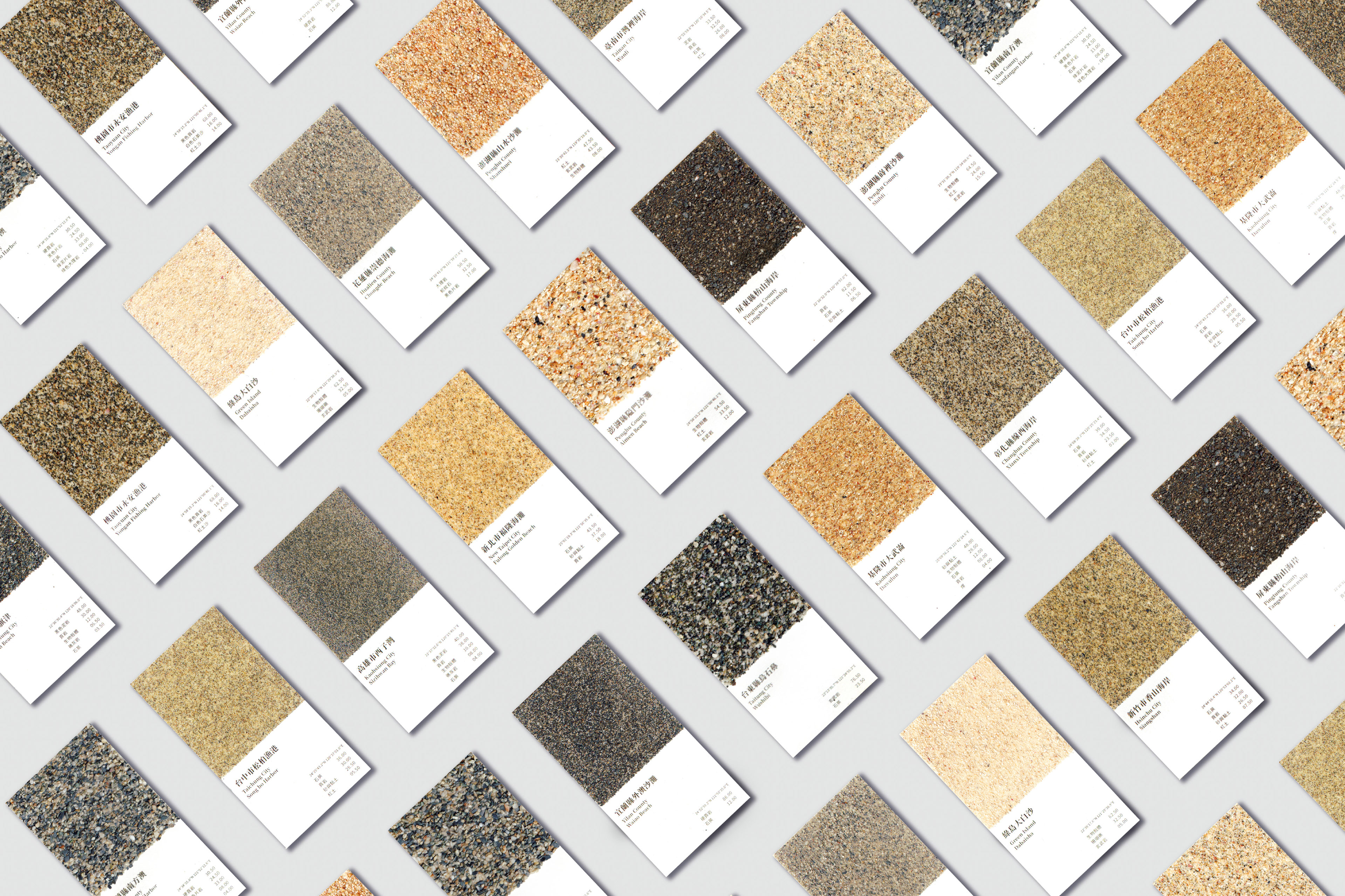
We work with National Taiwan University Geology Department to analyze the locations and compositions of sands in Taiwan. After it, we designed a swatch book and guidebook by the results.
Creativity:
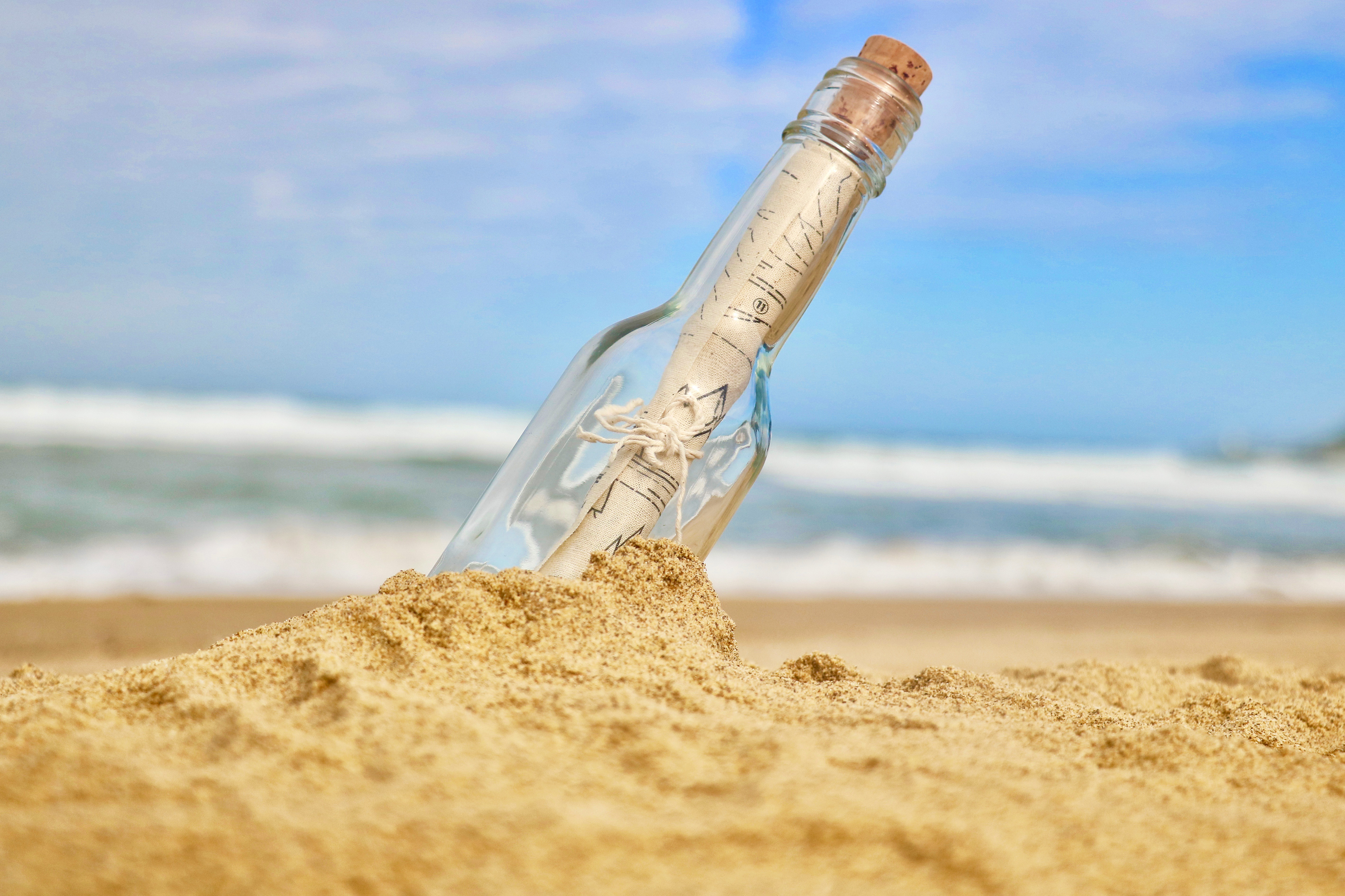
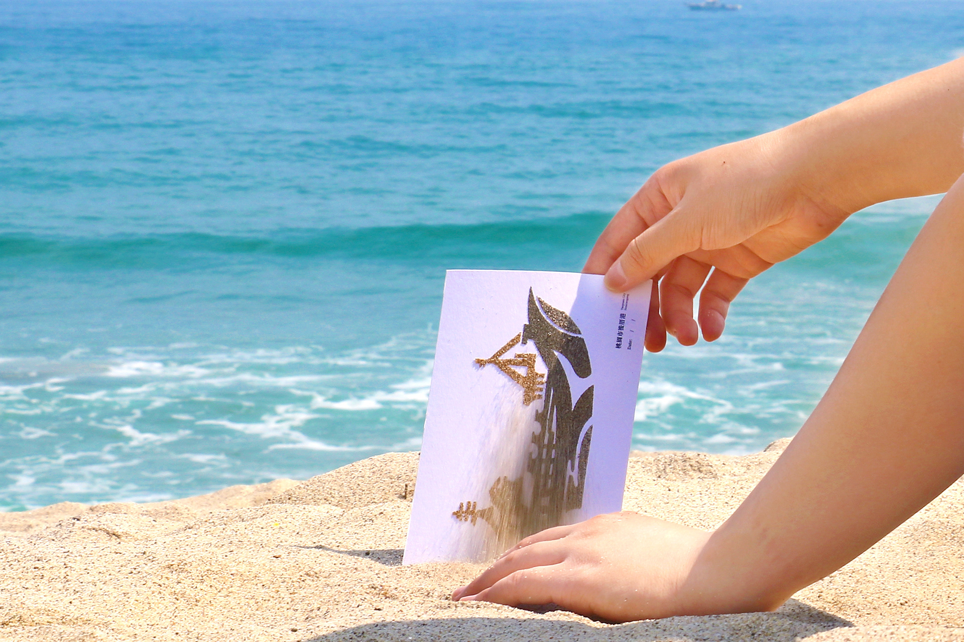
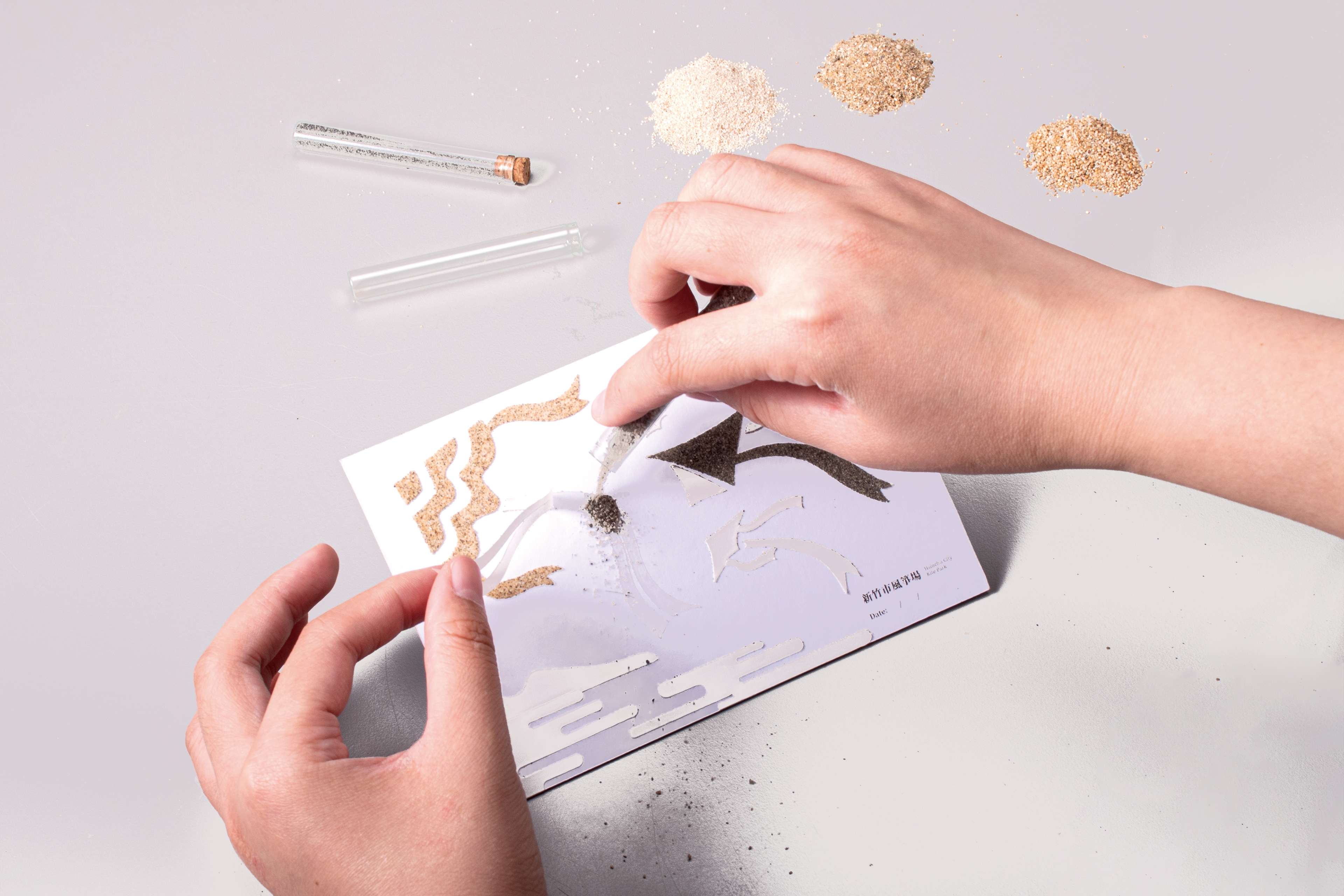
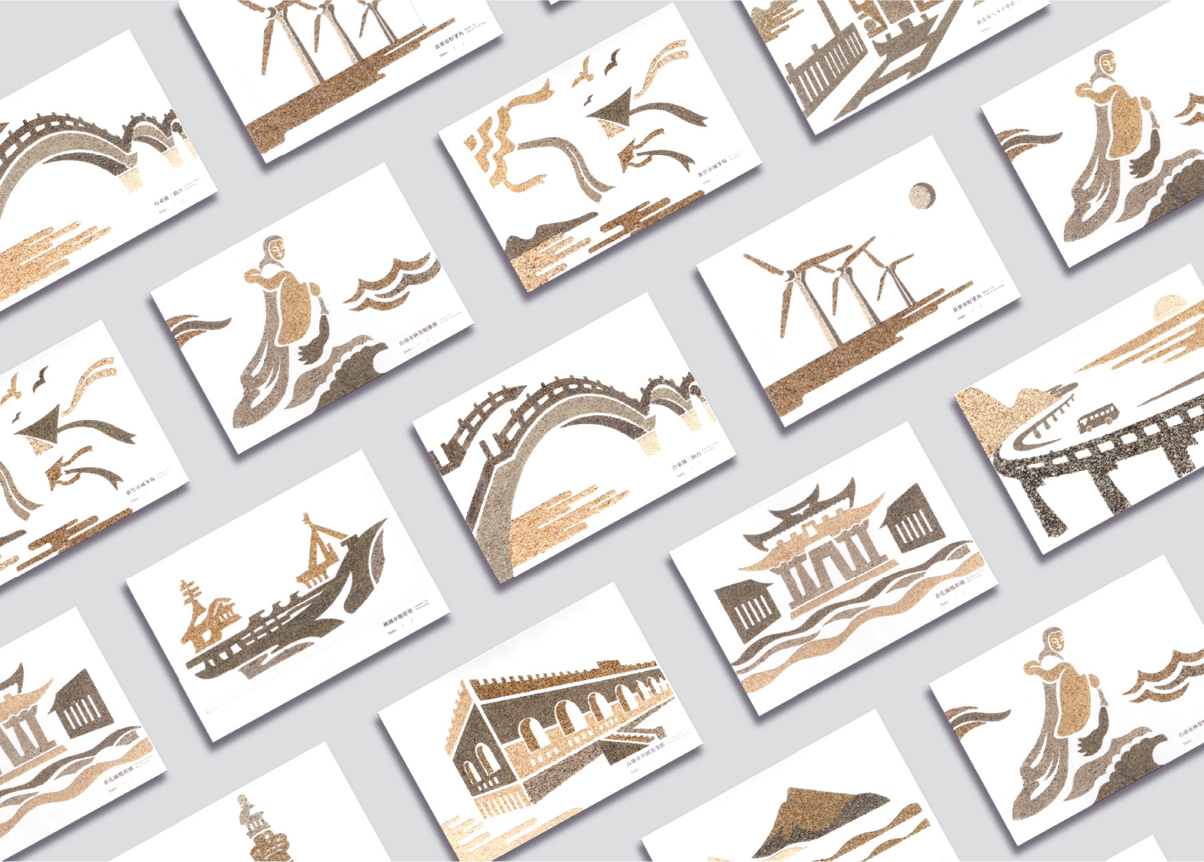
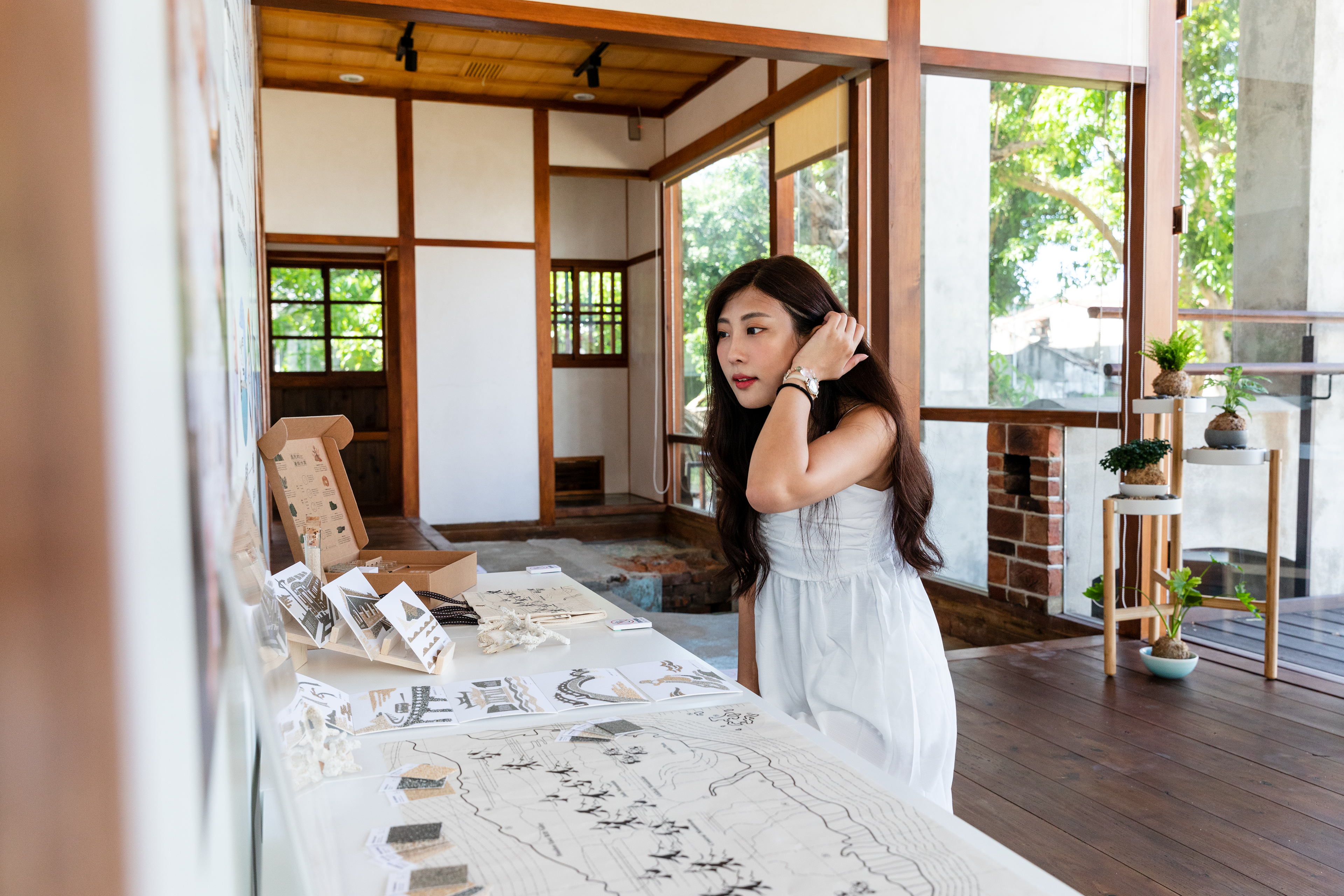
We remembered playing sand painting in childhood, so we innovated unique sand painting, each illustration comes from a different coastal landscape. Open the package, take out the manual and read it, you will find the corresponding sand swatches along with the map of the letter in the bottle. After that, take out the card originally affixed with the transparent sticker, tear off the sticker, and sprinkle with local sand to complete a part of the landscape painting. We have planned a round-the-island itinerary in Taiwan. If you want to complete the whole set of 12 picture cards, you need to go to various coastal experiences in Taiwan.
Outcome:
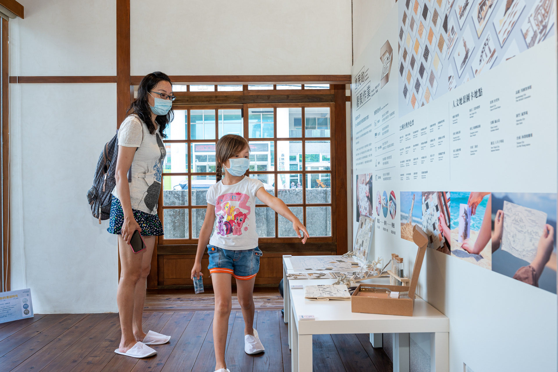
Our research and design results have also been shared with the government. We participated in the beach historical exhibition held by the Government of Keelung, Taiwan, leading the public to experience the beauty of sand color. At the same time, we also participated in the cultural asset preservation, exhibition held by the Ministry of Culture.
「暑假作業是大家兒時的共同回憶,而不同於以往沈悶的紙本作業,這是一份身為島民的我們都該做的功課!」台灣島嶼擁有多樣的海岸地形,卻因為曾是海防禁地而充滿神秘的色彩。我們研究了台灣沿海不同色系的沙,製成色票地圖,進而創造一個旅行的契機 —— 將沙,視為這座島上最不為人知的秘寶。邀請大家一起踏上這趟探索之旅,前往海岸認識人文地理,實地蒐集不同色彩與質地的福爾摩「沙」,親自創作最美的沿岸風景沙畫。
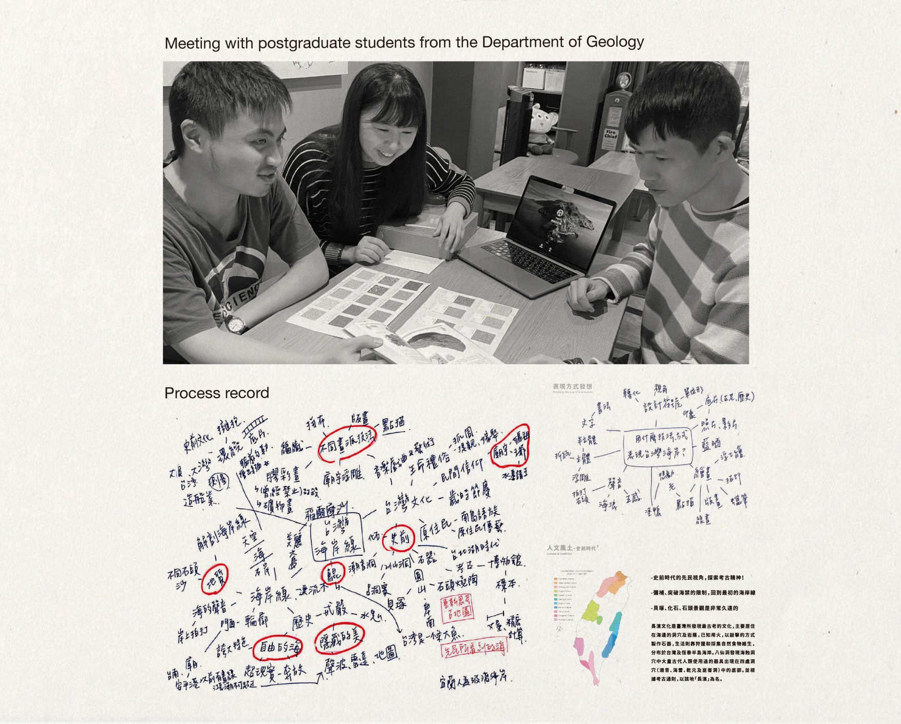
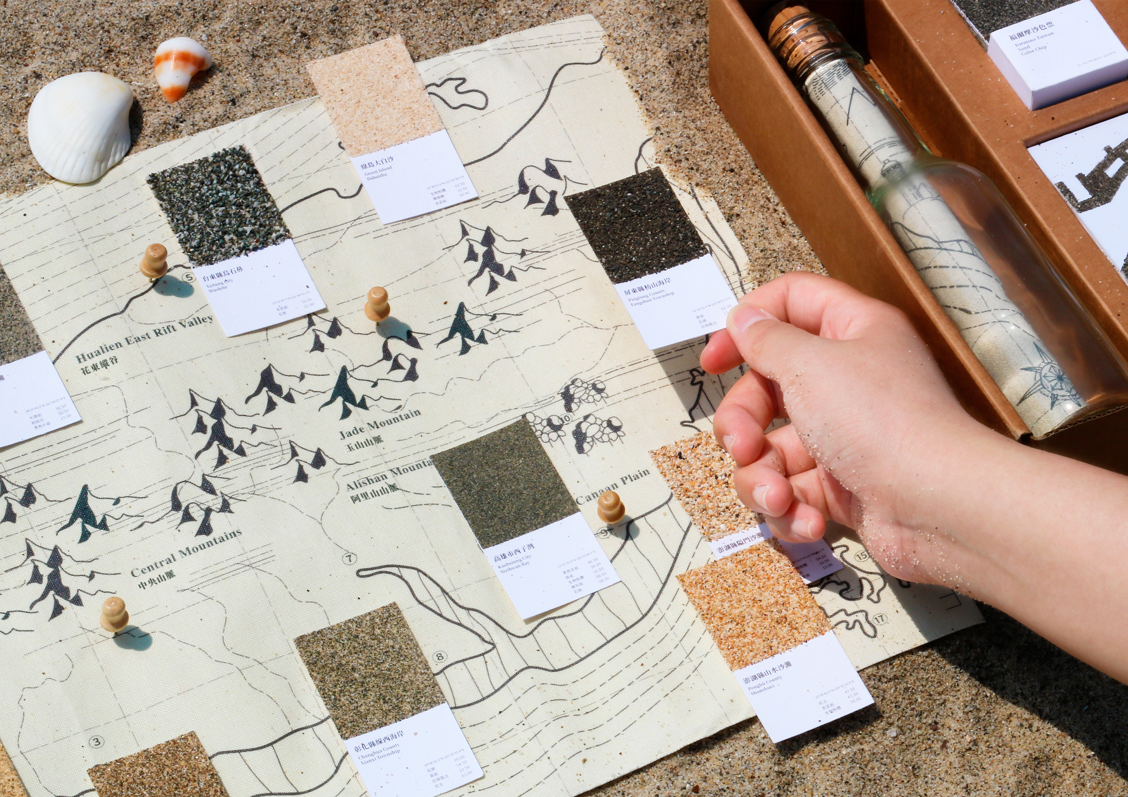
台灣的海沙,未經發掘,資料難尋,需要去實地取材才能做進一步研究。 有了這樣初步的想法,我們也與台大地質系合作。確認沙的多樣性與成因,並得到地質系的協助分析。- 他們詳盡的說明沙的成因,有很多不定性,如果分析得太深入做為學術研究, 很難呈現在一張小色票上。因此我們討論了要分析得多深,精準度與難處,最後我們希望以顏色上、質地上、趣味性較高、較吸引人的方式,進行分析!第一步會先進行顏色上的分析,進一步研究他們屬於哪條河流的沖刷、源自於哪座山脈、分別是什麼岩石成分。 各地區的地質都有所不同,像是黑沙可能的質地就有:頁岩、泥岩、玄武岩等等。而顏色也會因為氧化、或其他外在因素造成色相上的差異。因為沙的成因多樣,且粒子過細,無法再用顯微鏡進行化學式分析。因此只能依不同地域的地質研究,進行推測。經由分析,及整理這些色票,我們也了解不同顏色的沙分別分布在台灣的哪些地方。
We work with National Taiwan University Geology Department to analyze the locations and compositions of sands in Taiwan. The colors of sands are affected by the geological compositions where they exist. For instance, black sand has a high probability that comes from shale, mudstone or basalt. Even the same kind of sands may differ as a result of oxidation or other external factors. Examining the color of sands is the first step of the analysis. Afterwards, deeper researches will be followed up to find out which rivers or mountains it originates in, and what is its compositions. The sand in Qijin, for example, is dark gray in color, as it mainly comes from slate and quartz.
指導:鄭司維 教授
設計者:劉佳蓉 / 杜浩瑋
攝影:古峰銓
特別感謝:游鈞量 / 善慈 / 周翔彬 / 林奕儒 / 邱舒婷 / 林佳萱 / 應承宏 / 陳若潔